AGS Conecta
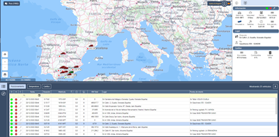
AGS Conecta is a multilingual web solution, compatible with the main browsers, aimed atattending the basic needs of control and management of location and telemetry data obtained online of the GPS/GPRS terminals on board the different vehicles in the fleet.
AGSConecta is a solution aimed at meeting the basic needs of localization, real-time control, and management for cold chain compliance during the transport of temperature-controlled goods, especially in refrigerated vehicle fleets of small companies, as well as to facilitate to our customer invited third parties, the visualization of the vehicles during the whole period they have contracted the transport service.
In addition, AGS Conecta offers a simple and intuitive interface, with a very fast display of the user requested data, either in real-time or from the stored historical data.
AGS Conecta has a remote update service, automatically applied when available, as soon as the user starts the application, to ensure continuous improvement and evolution.
Features
- GPS tracking and online visualization of fleet vehicles, as well as peripherals connected to the devices (CANBus, OBD II, immobilizer, etc.).
- Online historical data of up to one (1) year obtained from on-board devices.
- Professional cartography with multiple mapping types (general, satellite image, authorized roads, tolls, traffic, and night mode), with different fast and easy zoom functions, and with the possibility of points of interest (POI's) dynamic management and be grouped by categories.
- Quick route planning, from the real-time location to one or more points of destination, selected on the map, including indicated addresses and/or previously created points of interest.
- Simultaneous graphic analysis of the vehicle's activity in a period that includes;
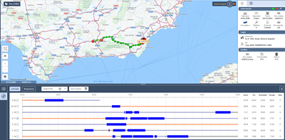
- Activity disk: All the trips made grouped daily and weekly, as well as the stops made with or without contact, and whether the place of the stop is known or not. It will also show a daily summary where the corresponding start/end activity and the total time of driving times, inactivity stops, stops during the day, and distance made will be shown.
- Speed disk: graphically represents vehicle’s speed for each trip made during the day and represented on the map in different colors depending on the defined speed range. It includes a summary of the maximum and average speeds made by the vehicle.
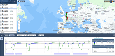
- Temperature disk: It graphically represents the daily recorded temperatures coming from the Conecta+ iTS Compact digital thermograph installed in the vehicle, and will also show the activity of the door (opening/closing) and the cooling motor (on/off) of the vehicle.
Multiple reports available, either directly from the map, or from each of the graphical analyses above.
Minimum requirements
Web browser (recommended):
- Chrome
- Edge
- Firefox


